Minister Manol Genov: Every third inspected water body on the Black Sea coast has violations
18 Nov, 2025 | 16:05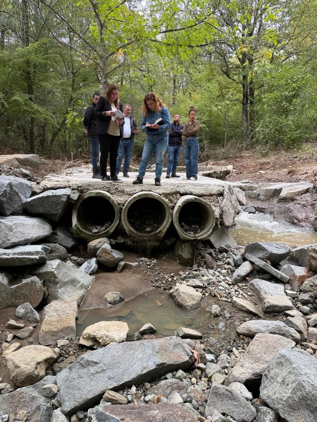
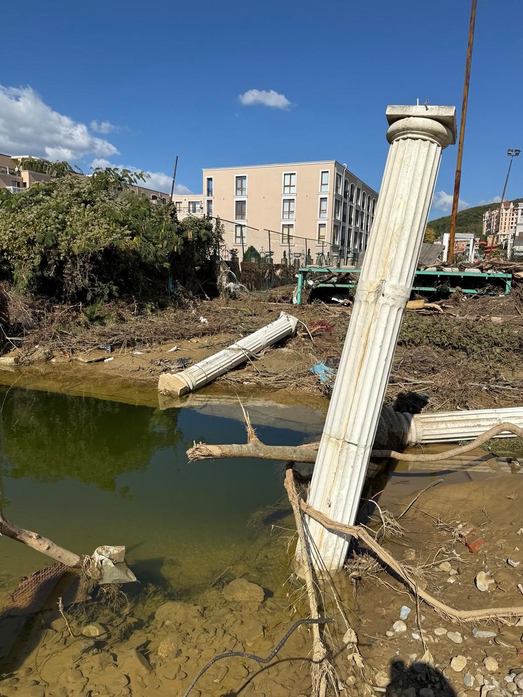
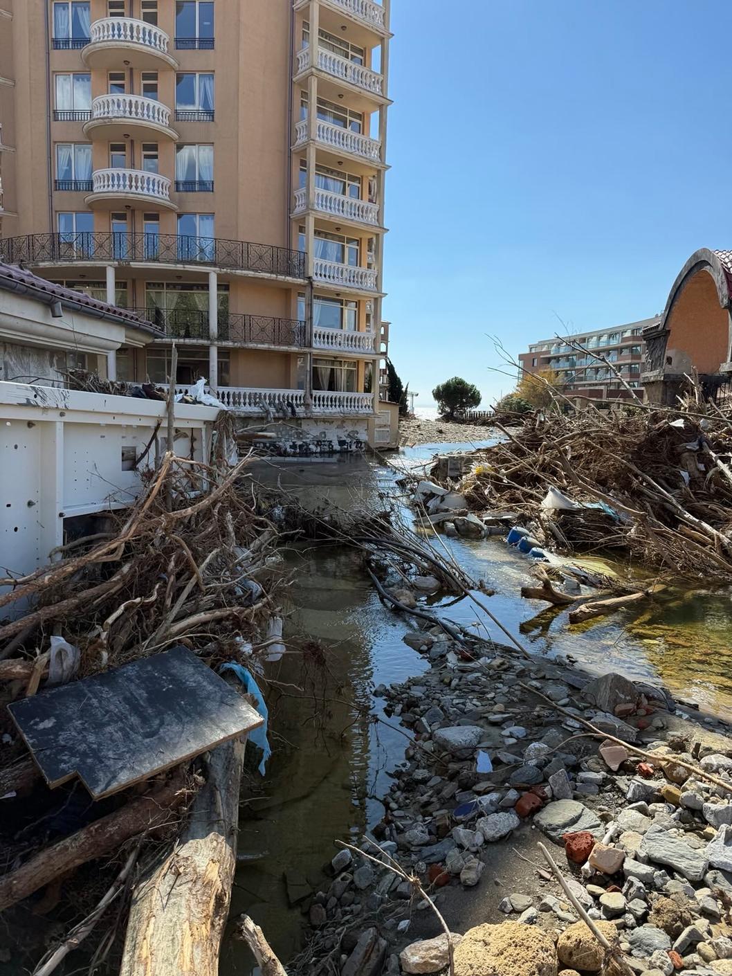
- Intense rainfall, small catchments, uncleaned rivers, old infrastructure, and failure to comply with coordination procedures are the causes of the disaster and damage of October 3
Less than half of the inspected water bodies along the Black Sea coast are in compliance with the relevant regulations. A signal of serious concern is the finding that almost every third of the inspected bodies has committed violations of legal requirements. This was stated by Minister Manol Genov after analyzing the results of the inspection carried out by teams of the Ministry of Environment and Water after the floods of October 3.
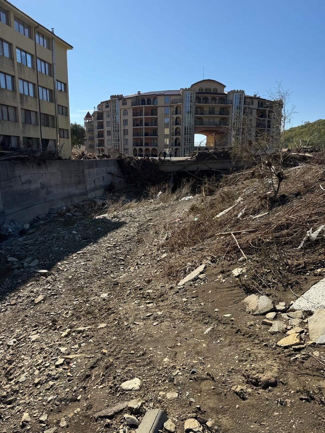
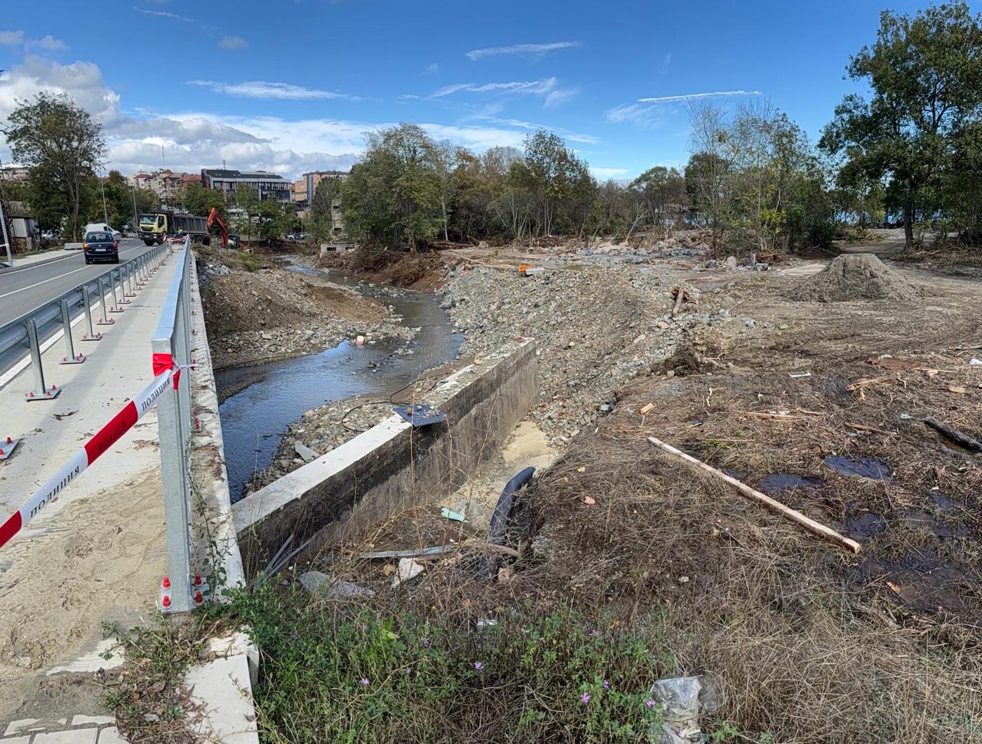
The inspection confirmed that in many areas the water bodies are not recorded on the cadastral map at all. This has allowed construction on river beds and ravines, as well as filling or covering water courses without coordination procedures with the Ministry of Environment and Water (MOEW) authorities under the Water Act. "Therefore, I ordered the findings from the inspections to be used to prepare combined maps with information about the water bodies on the cadastre, which have already been sent to the Ministry of Regional Development and Public Works and the National Construction Control Directorate," said Minister Manol Genov.
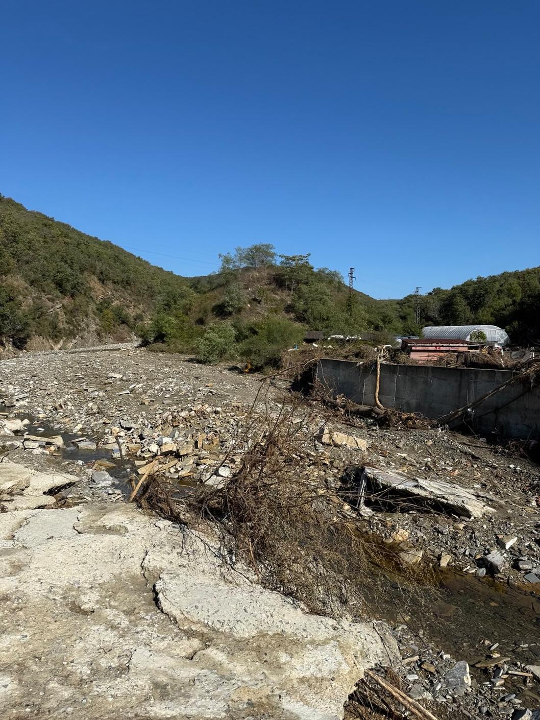
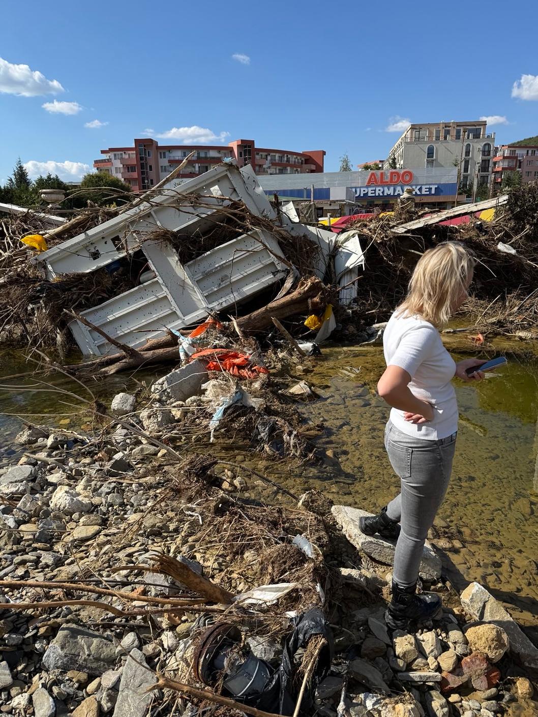
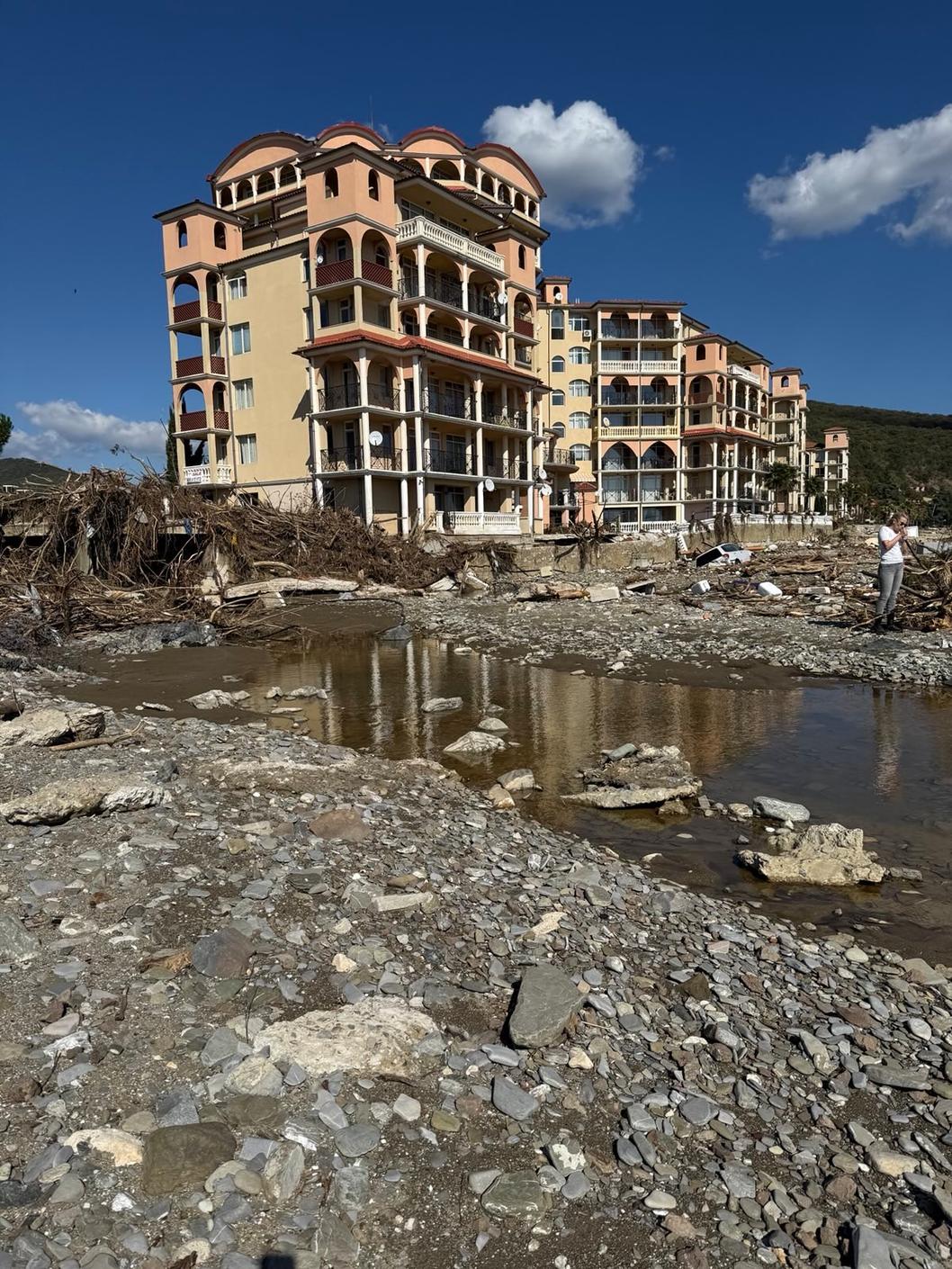
The teams inspected over 20 water bodies, covering 52 river sections - 16 on the Northern and 36 on the Southern Black Sea Coast. The results show that 27% of the surveyed river basins have violations, 38% comply with the regulations, and the rest require cleaning and monitoring. The most affected are St. Vlas, Elenite, Lozenets, Tsarevo, Sunny Beach, and Varna. Natural areas under protection, such as those along the Ropotamo, Veleka, Karaagach and Butamyata rivers, are in good condition.
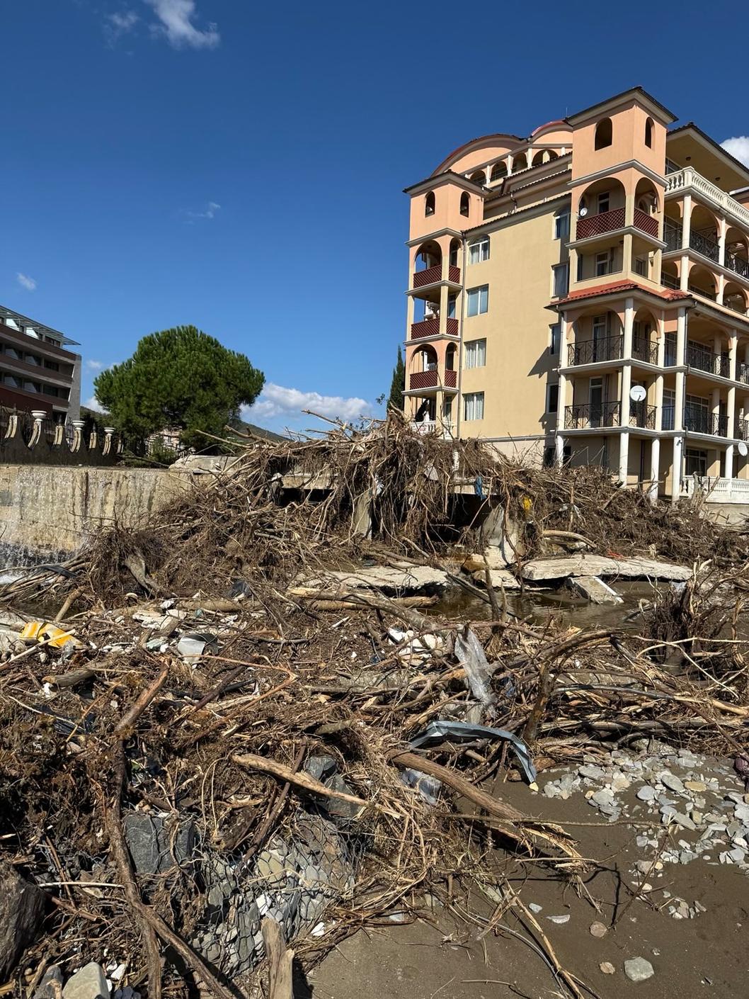
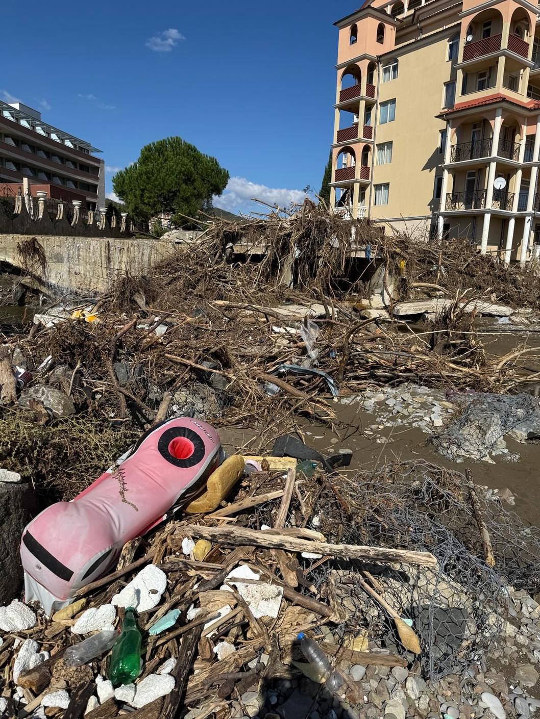
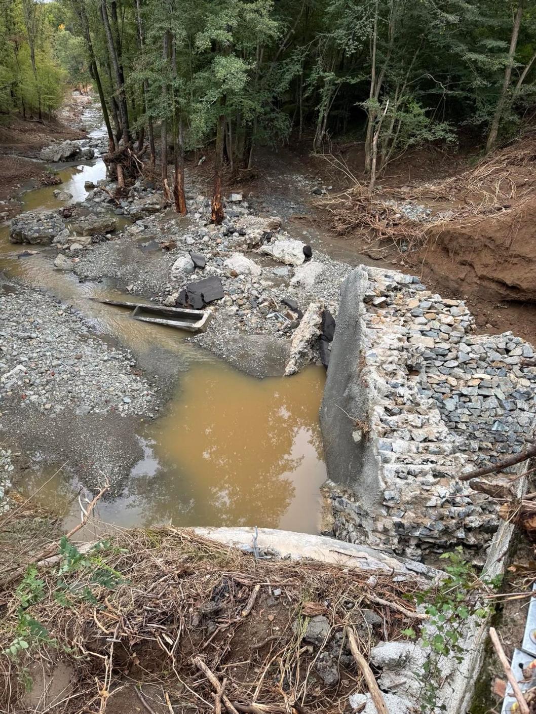
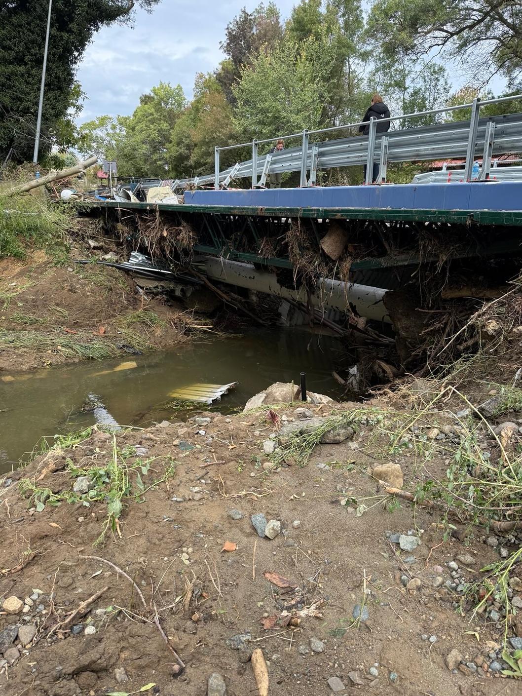
During the field visits, the inspectors identified 14 river sections with impaired conductivity, 7 covered or inserted into pipes, 9 with construction on them, 6 with corrections, 5 with corrections and cleaning. Only 8 sections are uncorrected, but cleaned, 10 are uncorrected and not cleaned, and there are no violations in only 20 sections.
In the urbanized areas of St. Vlas, Elenite, Lozenets, and Tsarevo, there is reduced conductivity of the watercourses, about which the Ministry of Environment and Water has promptly informed the mayors and regional governors. In the sections that are under protection, such as Ropotamo, Vaya, Karaagach, Aheloy, and Butamyata, there are no violations and the watercourses have natural conductivity, according to the analysis of the inspection data.
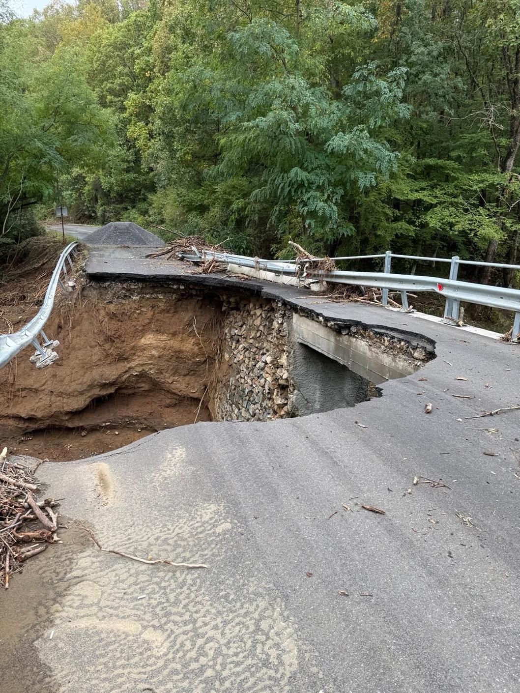
The causes of the disaster situation have also been analyzed. The floods on the Southern Black Sea Coast, including in the regions of Elenite and Tsarevo, are the result of a critical combination of natural and anthropogenic factors and failure to comply with explicit legal procedures - a combination that led to fatal consequences, the analysis shows.
The meteorological situation of intense short-term rainfall, which quickly accumulates water masses, is defined as a natural factor. At the same time, the small watersheds and the steep relief in combination with the immediate proximity of the erosion base to the sea coast, have predetermined the high speed of runoff and the sharp increase in water levels in the ravines. This has led to the formation of large volumes of water in a short time and their rapid transition to the coastal urbanized areas.
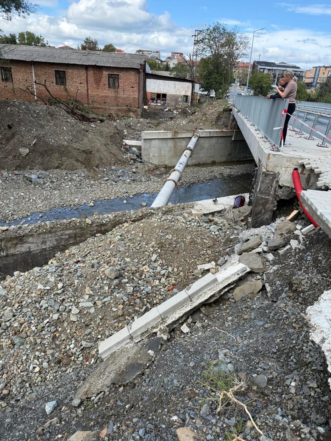
Anthropogenic, including infrastructural, factors are the hydrotechnical and road facilities, such as culverts, bridges, corrections, which are oversized for the current hydro-climatic conditions and do not provide the necessary conductivity during extreme rainfall. Many of these facilities are not maintained and are not in line with the new realities resulting from climate change, which is expressed in more frequent and intense short-term rains. Thus, construction in floodplain areas and covering river beds are a major factor in retaining and diverting the water masses that led to the floods.
The Ministry of Environment and Water is starting a full inventory and updating of data on water bodies along the coast. In parallel, control under the Water Act is also being strengthened, including imposing sanctions for unauthorized adjustments and construction of river beds. “We have already imposed our flood risk management plans on the existing cadastral maps and saw many discrepancies. In many areas, water bodies are not reflected on the cadastral map, which has allowed construction of river beds,” confirmed Manol Genov.
The inspections on the Black Sea coast were carried out by teams from the Ministry of Environment and Water, the Black Sea Basin Directorate - Varna, the Regional Inspectorate for Environment and Water – Varna, and the Regional Inspectorate for Environment and Water - Burgas. The detailed report with all findings will be sent to the competent authorities - regional governors, mayors of municipalities, the Ministry of Regional Development and Public Works, and the National Directorate for Construction Control, for taking action within their competence.
The combined flood risk maps and the cadastre can be seen on the official website of the Black Sea Basin Directorate.