The basin directorates have developed combined maps of flood risk and the cadastre
17 Dec, 2025 | 16:14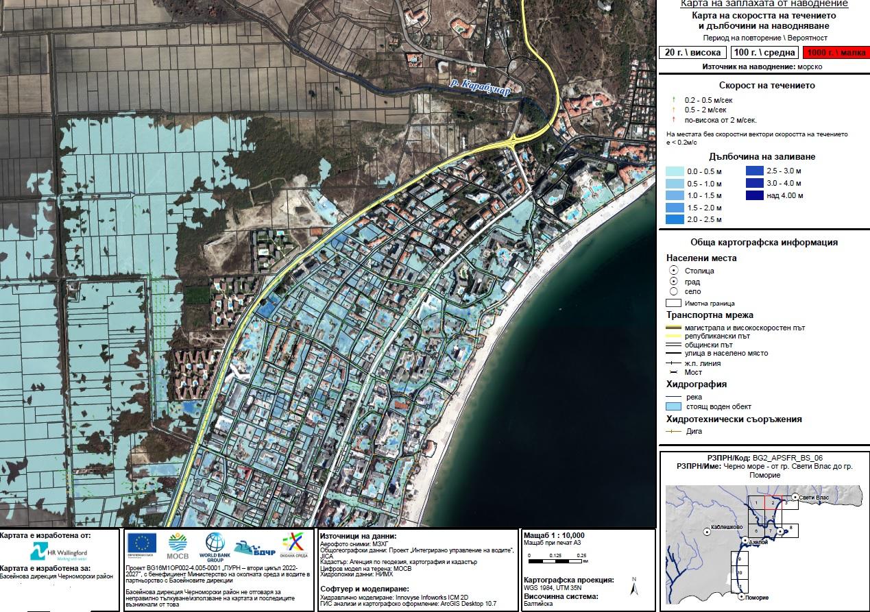
- When issuing building permits, it will be clear that no projects can be designed and built in these areas
By order of the Minister of Environment and Water Manol Genov, the four basin directorates have developed combined maps of the areas with a significant potential risk of flooding for the entire country.
The basin directorates "Danube Region" - Pleven, "Black Sea Region" - Varna, "Eastern Aegean Region" - Plovdiv, and "Western Aegean Region" - Blagoevgrad have developed combined maps that include information from the cadastral map, satellite images, and extracts from specialized maps at the corresponding scale. The aim is to ensure better visualization and analysis of vulnerable territories and areas with an increased risk of flooding.
The priority implementation of the task began in the Basin Directorate "Black Sea Region" - Varna in early October, immediately after the devastating floods on the Black Sea coast. It was there that the pilot model for integrating spatial data was implemented, which was subsequently expanded to other regions of the country.
This undertaking is part of the consistent efforts by the Ministry of Environment and Water to increase the effectiveness of water management, as well as to strengthen prevention and preparedness for flood risk at the national level. The combined maps and the detailed report with findings after the inspections will be sent to the competent authorities - regional governors, mayors of municipalities, the Ministry of Regional Development and Public Works, and the National Construction Control Directorate.
The integration of data into these maps aims to facilitate institutions to take actions within their competence for prevention and control of flood risk areas. Thus, local and regional authorities will have access to up-to-date information and - when issuing building permits and planning infrastructure projects - will be able to take into account the related flood risk areas. Final processing of the data and provision of public access to the combined maps is pending.